Kinkade Collection of Indigenous Language Maps: Department of Linguistics, UBC
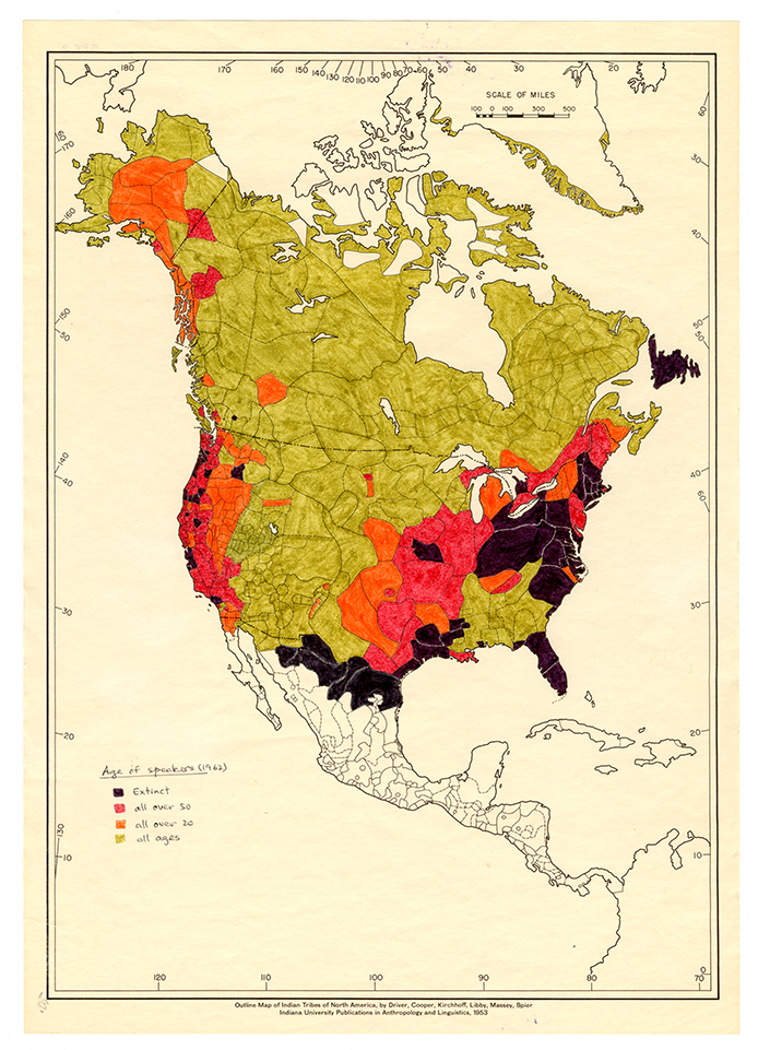
About the Collection The Kinkade Indigenous Language Map Collection comprises a portion of maps from the M. Dale Kinkade collection (dated from 1500 to 1985, published from 1953 to 1985) that have been held by the UBC Linguistics department since Kinkade’s passing and subsequent bequest of his collection of linguistic research materials. Our goal is to create a unique collection for the Linguistics department that will showcase the fieldwork that has been done in the past, as well as to provide a foundation for future work in digitizing and managing their collections of research. The maps, collected and created by the renowned linguist M. Dale Kinkade, show various aspects of linguistic fieldwork in Salish and neighbouring languages in the Pacific Northwest, as well as other indigenous languages of the world. The collection is unique to the department as a way to demonstrate the immensely significant and impactful work done by Kinkade, as well as giving a valuable resource for those interested in the study of indigenous languages, linguistic fieldwork, and indigenous peoples.

")


")


")


")

")


")
")
")