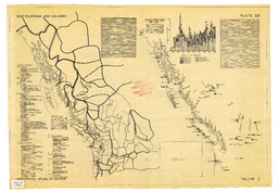
Diazo print (blue-line) mock-up of map for the Historical Atlas of Canada. The print shows the cartographic portion of the map and the location of the text blocks is noted but contain no text. The final map appeared as map 66 in Kerr, D. P. P. (1987). Historical Atlas of Canada: From the beginning to 1800 (Vol. 1). University of Toronto Press. Map portrays New Caledonia and Columbia ca. 1825